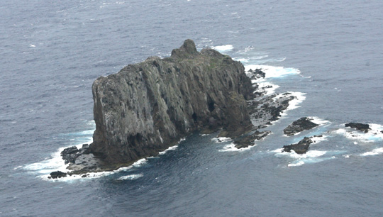
Topography of Taisho Island
-
Feb 17, 2015
Taisho Island is located roughly on the eastern edge of the Senkaku continental shelf. It is around 350 meters in length from east to west and 100 meters from north to south, with an elevation of approximately 81 meters. There seems to have been considerable development of Holocene era coral outcroppings around the island. (Ref. 1)
Note: Elevations given are based on the surveys of the time. (For current data, see "The Senkaku Islands: Location, Area, and Other Geographical Data.")


Ref.1 :Nohara Tomohide, "Senkaku Retto no chishitsu (yoho)" (Preliminary Report on Geology of the Senkaku Islands), in Senkaku Retto gakujutsu chosa hokoku (Report on the Senkaku Islands Scientific Expedition), based on a survey carried out by the University of the Ryukyus Scientific Expedition Team (Nishihara, Okinawa: University of the Ryukyus, 1971).

→


 RSS
RSS
Info Library
Japan's Island Territories
Senkaku Islands Facts & Figures
Takeshima Facts & Figures
Northern Territories Facts & Figures