 RSS
RSSRefutation of Korean Media Claims Regarding Japanese Maps of Takeshima(Part1)
Japanese Maps from the 1905 Incorporation into Japanese Territory Until 1945
Jul 08, 2015
|
This paper will be posted in two installments. Part 1 is displayed below; click the link to jump to Part 2 once it is uploaded. Part 1
Part 2
|
1. Introduction
In South Korea, there are news stories about the Takeshima dispute almost every day. Often the stories concern the discovery of new materials supporting Korean sovereignty of the island, but in these cases the materials are nearly always old Japanese and Korean maps. However, according to an essay by international law specialist Araki Norio, "In such cases as when maps are employed as an inseparable part of a treaty through amalgamation with the main text of the attached treaty or when certain maps are designated as the basis for a treaty establishing national borders, they can be said to be primary evidence. More than any other kind of map, these maps are given the highest priority as evidence. . . . Other maps have only been treated by international courts as secondary evidence at best, possessing only the value of hearsay evidence. The low reliability of the maps affects how they are assessed."1
Furthermore, even in the Korean media there are such statements as given in the article headlined "Argument That 'Dokdo [Takeshima] Is Korean Territory on Old Maps' Ineffective in International Adjudication" in the August 17, 2012, edition of the Hankyoreh newspaper, shortly after President Lee Myung-bak's visit to Takeshima. Based on precedents from International Court of Justice rulings in disputes between Thailand and Cambodia and between Malaysia and Indonesia, the article states:
In making decisions regarding territorial disputes, rather than "historical entitlement," according to which nation the territory was closest to, the ICJ places importance on the fact of continuous and peaceful exercise of sovereignty over a period in which the other country raises no questions regarding the territory. This means that the old maps sometimes presented in the domestic media as conclusive evidence that Dokdo is Korean territory may not be considered important factors in settling the dispute. It is also true that although the South Korean government has effectively controlled Dokdo for over 50 years, Japan's unstinting protest has denied the validity of this control.2
In other words, both these sources indicate that old maps are not especially important to the ICJ as evidence providing a basis for sovereignty.
Having said this, old Japanese and Korean maps are not only given prominence in Korean news stories but also many are displayed as a basis for Korean sovereignty over Takeshima in both the Dokdo Museum in Ulleungdo, which members of the Shimane Prefecture Takeshima Issue Research Group visited in 2006, and the recently opened Dokdo Museum Seoul. I have examined how Takeshima has been represented on old Korean maps, Western maps, and such Japanese maps as those produced in the Edo period (1603-1868) by Nagakubo Sekisui and Hayashi Shihei, as well as government maps published from the Meiji era (1868-1912) through the end of World War II.3
As a continuation of those investigations, this article will take a historical geographical perspective in countering recent Korean media claims regarding maps published by the Japanese government between 1905, when Takeshima was incorporated into Shimane Prefecture, and 1945. It will examine the 1936 map Chizu kuiki ichiranzu (District Overview Map), reported on by South Korea's Yonhap News on October 24, 2012, and the 1931 map Nihon rekishi chizu (Japanese Historical Map), reported on by South Korea's YTN News on March 1, 2013.
2.Chizu kuiki ichiranzu (District Overview Map), Land Survey Department (1936)
First of all, as it is an online article, and may be deleted in the future, I would like to cite this article from October 24, 2012, in full.4
Restored Japanese Gov't Map shows Dokdo as Korean territory
http://english.yonhapnews.co.kr/search1/2603000000.html?cid=AEN20121024008400315
(Seoul, Yonhap News) - Restoration has been completed on a Japanese map that proves Dokdo is Korean territory. This is the District Overview Map, published by the Japanese government in 1936, which played a decisive role in the Allied Forces' recognition after World War II that Dokdo is Korean territory. On October 24, after five months of work, the National Archives of Korea announced that it had completed restoration of the District Overview Map, performed at the request of the Independence Hall of Korea. It was originally printed as a double-sided map, but the back of the map was covered by both paper and a frame, meaning it was impossible to check its original state.
The National Archives team removed the paper from the back of the map and sealed it ultrasonically to return it to its original state. The above photographs show the front of the map before (left) and after restoration and the below photographs show the back before (left) and after.
October 24, 2012. Ministry of Security and Public Administration. photo@yna.co.kr
National Archives of Korea Completes Restoration of District Overview Map Published by Japan in 1936
Clearly Delineates Dokdo as Part of Korea
By Lee Yul
(Seoul: Yonhap News) - Restoration has been completed on a 1930s Japanese map that clearly shows Dokdo is Korean territory.
This is the District Overview Map, published by the Japanese government in 1936, which played a decisive role in the Allied Forces' recognition after World War II that Dokdo is Korean territory.
On October 24, after five months of work, the National Archives of Korea announced that it had completed restoration of the District Overview Map, performed at the request of the Independence Hall of Korea.
The District Overview Map was produced by the Japanese government's mapping agency, the Land Survey Department, which was under the direct control of the Imperial Japanese Army General Staff Office, and shows territory within Japan and the Japanese Empire, such as Korea, Taiwan, and Hokkaido, divided into different areas.
Particularly notable is that Dokdo and Ulleungdo are depicted precisely together within the Korean area with a thick line dividing the Korean and Japanese areas, so this map is considered a key record that demonstrates the Japanese government recognized that Dokdo is Korean territory.
The map was donated to the Independence Hall of Korea in 1988 by bibliographer Lee Jong-hak.
It was originally printed as a double-sided map, but the back of the map was covered by both paper and a frame, meaning it was impossible to check its original state.
The National Archives team removed the paper from the back of the map and sealed it ultrasonically to return it to its original state.
Shin Yong-ha (University of Ulsan endowed chair professor), chairman of the Dokdo Research Institute, stated, "The District Overview Map became an important source in the Allied Forces' recognition that Dokdo is Korean territory when they dismantled the colonies of the Japanese Empire after it collapsed on August 15, 1945."
Lee Sang-tae, chairman of The Korean Research Association of Old Maps, explained that "The Land Survey Department, which published this map, was under the direct control of the Imperial Japanese Army General Staff Office and was an official organ of the Japanese government. . . . The fact that the Japanese government officially published a map including Dokdo as part of Korea can be seen to indicate that Japan officially saw Dokdo as an inherent part of Korean territory."
The Independence Hall of Korea plans to display the map in the near future.
October 24, 2012. Posted at 12:00.
As stated in the article, in the Chizu kuiki ichiranzu (District Overview Map) published by the Land Survey Department in 1936, Takeshima is situated to the southeast of Ulleungdo and appears to be within the Korean area (figures 1 and 2). The crucial point here is first of all whether this record actually indicates that Takeshima was administratively part of Korea.
Looking at Chosen jijo Showa 12 nen ban (Korean Affairs 1937), compiled and published by the Governor-General of Korea on December 27, 1936, the "Topography" section of "1. General Remarks" on page 1 defines the boundaries of Korea as "from 124°11′ E to 130°56′23'' E and from 33°6′40 '' N to 43°0′36''N," setting the eastern boundary at 130°56′ E. By comparison, in Chosen chishi shiryo (Materials on Korean Topography), also published by the Japanese colonial administration on March 15, 1919, the section "Chart 1: Longitude and Latitude Limits for the Korean Peninsula" in "1. Overview" on page 1 gives the same longitude and latitude limits for Korea, defining the eastern boundary as 慶尚北道鬱陵島竹島 (Ulleungdo and Jukdo in North Gyeongsang Province). Here 竹島 is not Takeshima, although it is written the same, but the island known as Jukdo in Korean (now written 竹嶼 in Japanese), which lies two kilometers to the northeast of Ulleungdo. As the longitude for Takeshima is 131°52′ E, even when the District Overview Map was published in 1936, the island was not under the jurisdiction of the Governor-General of Korea.
Figure 1: Section of the Chizu kuiki ichiranzu (District Overview Map), Land Survey Department (1936).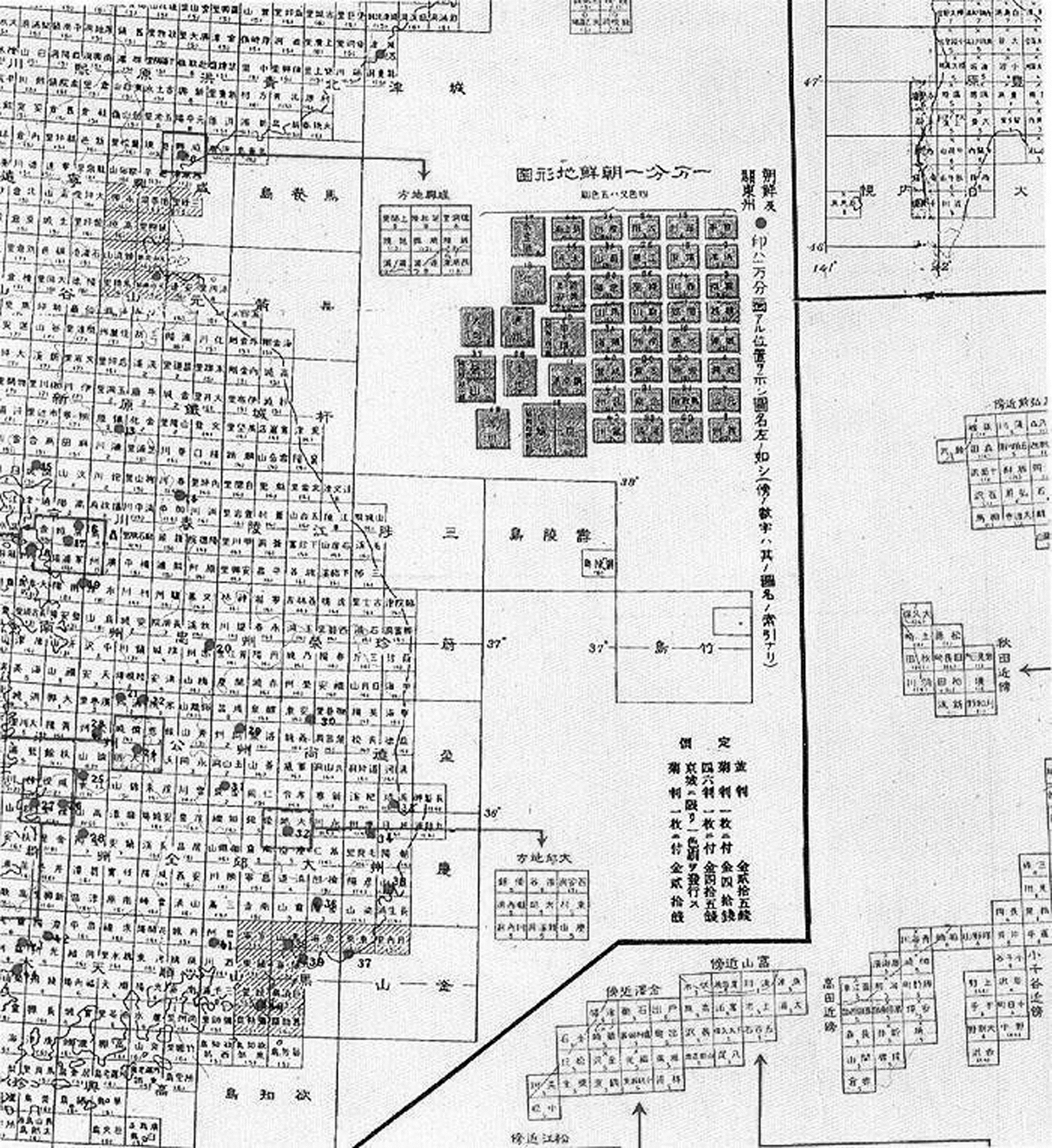
Figure 2: Entire Chizu kuiki ichiranzu (District Overview Map), Land Survey Department (1936).
The Chosen chizu (Map of Korea) on a scale of 1:2,500,000, also published by the Governor-General of Korea on December 1, 1938, similarly shows Korea's eastern boundary as extending no further than Ulleungdo with Takeshima not appearing on the map (figure 3). Accordingly, we can confirm that Takeshima was not under the jurisdiction of the Governor-General in 1936.
Administratively, Takeshima came under the jurisdiction of the Oki Islands Office of Shimane Prefecture in 1905. How did it appear on official maps published by the Japanese government after that time? In the To-A yochizu: Matsue (Map of East Asia: Matsue) published on a scale of 1:1,000,000 by the Land Survey Department on August 10, 1909, Takeshima is shown as part of "Oki, Shimane Prefecture" (figure 4). Production of the To-A yochizu (Map of East Asia) began in 1894, and it divided the entire region from Japan and eastern Siberia to southern China into 241 area maps. The Map of East Asia: Matsue displays "Takeshima (Oki, Shimane Prefecture)" in the northwest of the Oki Islands and further northwest shows "Ulleungdo (Matsushima), Gangwon Province, Korea."
Furthermore, the Rikuchi sokuryobu hakko chizu kuiki ichiranhyo (Table of Map Districts Published by the Land Survey Department) for April 1937 has a table for the 1:1,000,000-scale Map of East Asia, which gives map numbers and years the plates were produced (figure 5). The map number for Matsue is 29 and the production year is 9; a note explains that "9" refers to Taisho 9 (1920). Produced in 1920, the Map of East Asia: Matsue was published on July 30, 1921. The map indicates that "railways were added in 1920." Takeshima and Ulleungdo are displayed in the same way as in the 1909 edition: "Takeshima (Oki, Shimane Prefecture)" and "Ulleungdo (Matsushima), Gangwon Province, Korea." Therefore, even if Takeshima appeared together with Ulleungdo in the "Korea" area of the 1936 District Overview Map, the following year, in 1937, there is reference to the Map of East Asia: Matsue on a scale of 1:1,000,000 in the Table of Map Districts Published by the Land Survey Department introducing the map that was produced in 1920; in this 1920 map, published in 1921, it is written "Takeshima (Oki, Shimane Prefecture)." As we can thereby confirm that the map was still being sold in April 1937, we can further corroborate that from 1937 Takeshima was not under the jurisdiction of the Governor-General of Korea, but the Oki Islands Office of Shimane Prefecture.
Figure 3: Chosen chizu (Map of Korea), Governor-General of Korea (December 1938).
Figure 4: Section of the To-A yochizu: Matsue (Map of East Asia: Matsue) 1:1,000,000, Land Survey Department (1909).
Figure 5: Section of the Rikuchi sokuryobu hakko chizu kuiki ichiranhyo (Table of Map Districts Published by the Land Survey Department) (April 1937).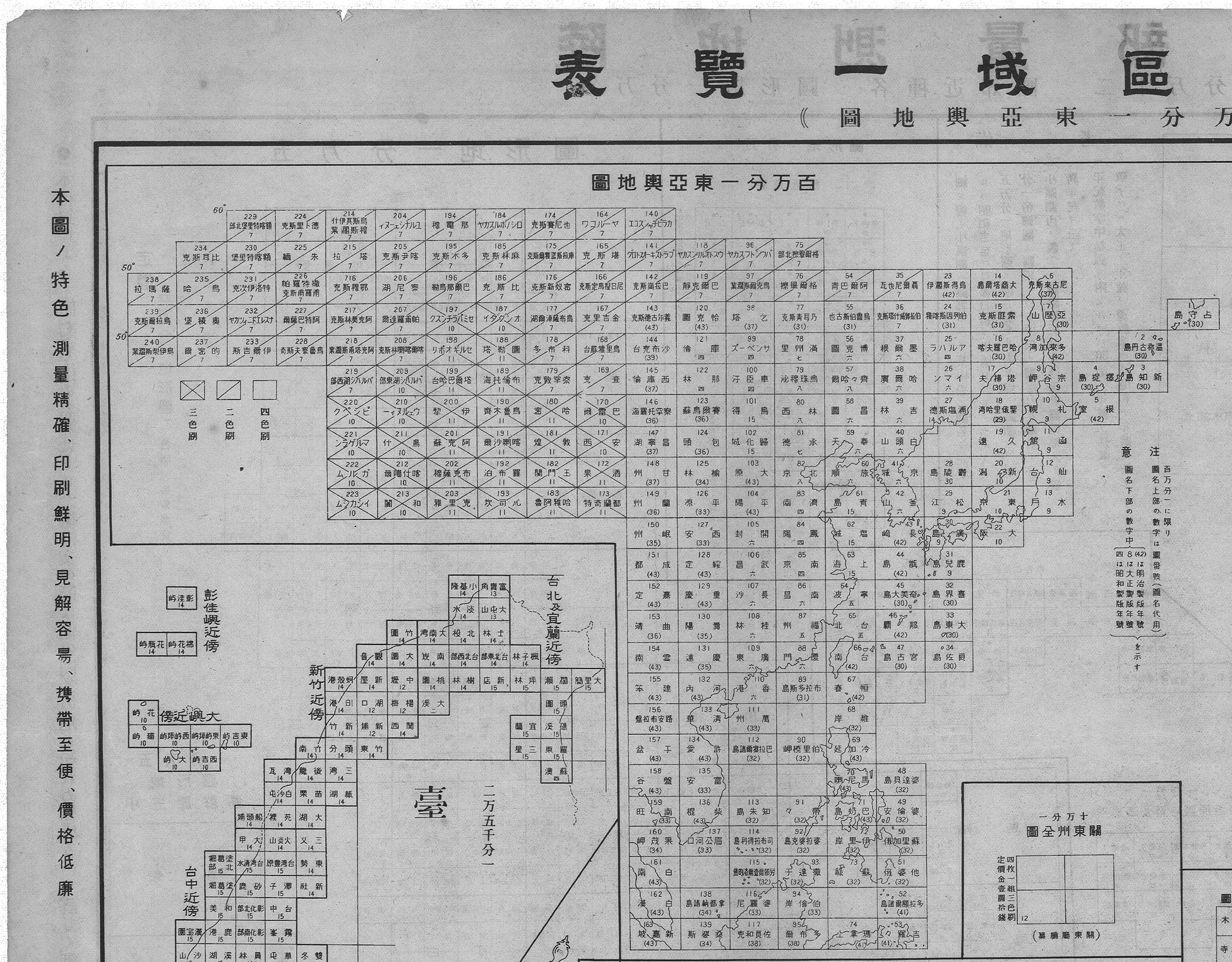
Next, as the Land Survey Department, which produced the District Overview Map, was an external bureau of the Imperial Japanese Army General Staff Office, it may have been connected with the army districts, so I will consider these. Military Ordinance 3 of September 17, 1907, amended the table of army districts, establishing the Matsue Regimental District. The ordinance placed part of Shimane Prefecture, Tottori Prefecture, and Okayama Prefecture in the Matsue Regimental District, which belonged to Divisional District 17, Brigade District 34. According to the table, Shimane Prefecture contained "Matsue City, Yatsuka District, Nogi District, Ohara District, Nita District, Iishi District, Suki District, Ochi District, Ama District, Chibu District." Although Takeshima was not then part of the four Oki districts, as it was under the jurisdiction of the Oki Islands Office, it can be considered to have been in the Matsue Regimental District.
Military Ordinance 2 of April 6, 1925, further amended the table of army districts, abolishing brigade districts; Matsue Regimental District became part of Divisional District 10 and the districts for which it had jurisdiction were changed. In Shimane Prefecture, "Suki District, Ochi District, Ama District, Chibu District" were changed to "Oki Islands." As Takeshima was then under the jurisdiction of the Oki Islands Office, it can still be considered to have been in the Matsue Regimental District. On November 1, 1941, the table of army districts was amended again, abolishing the Hamada Regimental District, which was incorporated into the Matsue Regimental District, so that it had jurisdiction over the whole of Shimane Prefecture (Military Ordinance 20, August 5, 1941). Looking at the Rikugun kankuhyo (sono ichi) (Table of Army Districts, Part One) of the time, the complete area of Shimane Prefecture is under the jurisdiction of Matsue Regimental District, Hiroshima Divisional District, Western Army District. This confirms that for the army Takeshima was consistently under the jurisdiction of Matsue Regimental District from 1907 onward.
On the other hand, under the Korean military headquarters regulation in Military Ordinance 4 of May 29, 1918, the army in the Korean peninsula was organized in the following way. "Article 1: The commander of the army in Korea is an army general or lieutenant general, leads the military units stationed in Korea (except the Korean military police), which are directly subordinate to the emperor, and is responsible for the defense of Korea." It is possible to confirm that the commander of the army in Korea had jurisdiction over "Korea," or in other words, the area controlled by the Governor-General of Korea. As I have already shown that Takeshima was not under the Governor-General, it follows that it was not under the jurisdiction of the commander of the army in Korea. Furthermore, in Military Ordinance 20 of August 5, 1941, Rikugun kankuhyo (sono ni) (Table of Army Districts, Part Two) includes the Korea, Taiwan, and Kwantung Army; North Gyeongsang Province, which Ulleungdo is part of, comes under the jurisdiction of the Daegu Military Affairs District, Seoul Divisional District, Korea Army District. Accordingly, as Takeshima was not under the jurisdiction of the Governor-General of Korea, but the Oki Islands Office of Shimane Prefecture, even in 1941 it was not in the Korea Army District.
Next, I will consider naval districts. Under the Kaigunku ni kansuru ken (Regarding Naval Districts) amendment of December 16, 1910 (Imperial Edict 452), the naval districts were changed with the Fourth Naval District defined as "the coastline and sea from the boundary between the Otsu and Toyoura Districts of Nagato Province along the west coast of Japan to the boundary between Ugo and Mutsu Provinces, and the coastline and sea of the Oki Islands and Sado Island," and Maizuru set as its naval base. The Fifth Naval District was defined as "the coastline and sea of Tsushima and Korea," and Jinhae in South Gyeongsang Province, Korea set as its naval base. Takeshima was under the jurisdiction of the Oki Islands Office of Shimane Prefecture and not the Governor-General of Korea; it belonged to the Fourth Naval District.
The enactment of the Naval Districts Edict of March 24, 1923 (Imperial Edict 56), amended the number of naval districts to three. Shimane Prefecture became part of the Second Naval District and Korea became part of the Third Naval District, along with some of Kyushu. As above, Takeshima was under the jurisdiction of the Oki Islands Office of Shimane Prefecture and not the Governor-General of Korea, so it belonged to the Second Naval District.
On April 30, 1937, the Naval Districts Edict was amended (Imperial Edict 161), changing the boundaries of the naval districts and further dividing them into land and sea districts. Shimane Prefecture remained part of the Second Naval District and Korea, some of Kyushu, and Taiwan made up the Third Naval District. As above, Takeshima was under the jurisdiction of the Oki Islands Office of Shimane Prefecture and not the Governor-General of Korea, so it belonged to the Second Naval District. This confirms that when the District Overview Map was published in 1936, Takeshima was also not located in the naval district that included Korea.
Next, I will examine the structure of the 1936 District Overview Map, the subject of the recent report. On the cover is written, "District Overview Map (Part One) Published by the Land Survey Department: 1:50,000, 1:25,000, 1:10,000 Topographical Maps." Of the topographical maps published by the Land Survey Department, first of all, among the names of the scales of the 1:200,000 maps, the 1:50,000 topographical map names are written in black and in the margin the 1:25,000 and 1:10,000 topographical map names are written in red (figure 2).5 Its basic structure is almost the same as the Rikuchi sokuryobu hakko chizu kuiki ichiranzu (District Overview Map Published by the Land Survey Department) (figure 6), produced in September 1931 and revised in March 1932, made up of "Kwantung Territory," "Korea," "Karafuto [Sakhalin]," "Chishima Islands [Kuril Islands]," "Hokkaido, Honshu, Shikoku, Kyushu," "Ogasawara Islands," "Nansei Islands," and "Taiwan." Takeshima appears in the "Korea" section, to the southeast of Ulleungdo.
As in the 1936 publication, the Rikuchi Sokuryobu hakko chizu kuiki ichiranhyo: Chosen no bu (Table of Map Districts Published by the Land Survey Department: Korea Section), thought to have been published in February 1941, shows Takeshima to the southeast of Ulleungdo in the "Korea" section (figure 7). In both of the editions of the District Overview Map, Takeshima is included fully annotated at the 1:200,000 scale, but at the 1:50,000 scale the island appears within the area without the annotation "Takeshima." On the other hand, in the 1936 edition there is a "6" for Ulleungdo, indicating that the 1:50,000 topographical map of Ulleungdo was published in Taisho 6 (1917). In the Table of Map Districts Published by the Land Survey Department: Korea Section, thought to have been published in February 1941, although the table with 65 maps of Korea at a scale of 1:200,000 includes "Ulleungdo," it does not include Takeshima. This means that ultimately neither a 1:200,000 scale map nor a 1:50,000 scale map of Takeshima were published.
Figure 6: Rikuchi sokuryobu hakko chizu kuiki ichiranzu (Map District Overview Published by the Land Survey Department) (Revised March 1932).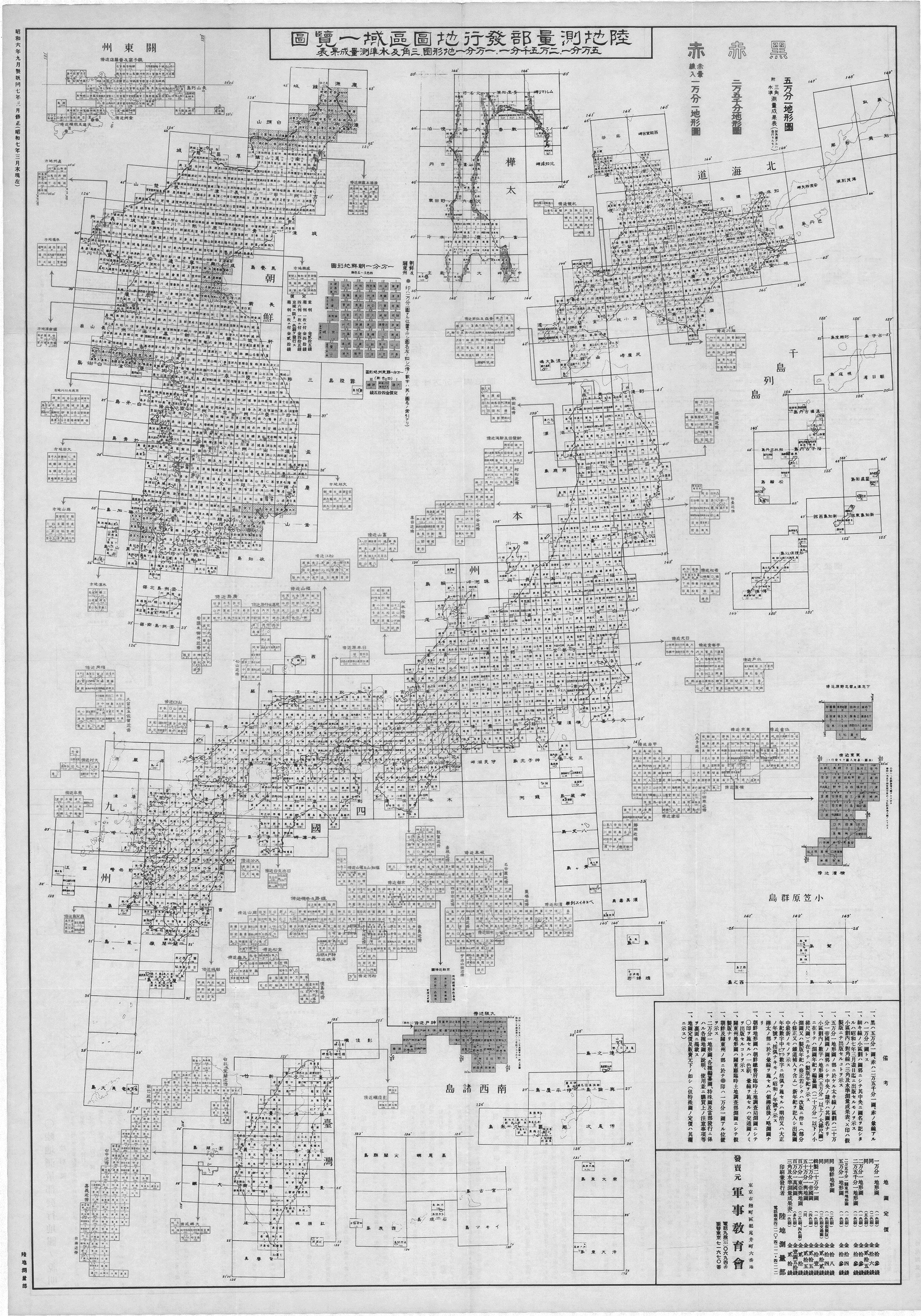
Next, while considering the 1932 edition, I would like to examine the structure of the 1936 District Overview Map in further detail (figures 2 and 6). According to the report in question, Shin Yong-ha, chairman of the Dokdo Research Institute, stated, "The District Overview Map became an important source in the Allied Forces' recognition that Dokdo is Korean territory when they dismantled the colonies of the Japanese Empire after it collapsed on August 15, 1945." Is this assertion actually true?
First, the 1:200,000 "Chishima Islands [Kuril Islands]" map includes from Urup Island to Shumshu Island; Japan renounced territorial rights to these islands in the postwar San Francisco Peace Treaty. Meanwhile, the 1:200,000 map for "Hokkaido" extends as far east as "Shibetoro" and "Bettobu" in the northeast extremity of Etorofu Island, meaning that Etorofu Island formed part of the Hokkaido area.
The southeastern extremity of the "Honshu" area is the Izu Islands, and the 1:200,000 map extends as far as "Torishima Island" and "Sofugan Island." The 1:200,000 "Ogasawara Islands" map includes "Mukojima Island," "Chichijima Island," "Hahajima Island," "Nishinoshima Island," "Kitaioto Island," "Ioto Island," "Minamiioto Island," and "Minamitorishima Island." However, Okinotorishima Island, which was incorporated into the area for the Ogasawara Branch Office of Tokyo Prefecture in 1931, is not included.
The 1:200,000 map for the "Kyushu" area extends as far south as "Amamioshima Island," which is part of the Nansei Islands. The 1:200,000 "Nansei Islands" map includes "Tokunoshima Island," "Yoronjima Island," "Iheyajima Island," "Nakaoshi," "Naha," "Kumejima Island," "Okinotorishima Island," "Minamidaitojima Island," "Okidaitojima Island," "Sekibisho [Taisho Island]," "Senkaku Islands," "Miyakojima Island," "Ikimajima Island," "Ishigakijima Island," and "Iriomotejima Island." The Daito Islands and the Senkaku Islands, both of which were incorporated into Okinawa Prefecture during the Meiji era (1868-1912), appear on the map. Okinotorishima Island (now written 沖ノ鳥島), which was incorporated into the area for the Ogasawara Branch Office of Tokyo Prefecture in 1931, also appears as 沖鳥島. Written at the top left of the map is "136°," indicating longitude, and at the bottom left is "20°," indicating latitude. As the coordinates for Okinotorishima Island are 20°25′ N, 136°4′ E, this indicates that the map is undoubtedly of Okinotorishima Island. Therefore, it is clear that the districts in the District Overview Map neither indicate geographical nor administrative districts, but only convenient divisions for the formation of this map. In other words, even if Takeshima is included in the "Korea" section, we can confirm that the interpretation by Lee Sang-tae, chairman of the Korean Research Association of Old Maps, that "The fact that the Japanese government officially published a map which included Dokdo as part of Korea can be seen to indicate that Japan officially saw Dokdo as an inherent part of Korean territory" is completely groundless.
Shin Yong-ha writes in a book translated into Japanese by Han Song as Shiteki kaimei Tokuto (Takeshima) (A Historical Explanation of Dokdo [Takeshima]), and published in 1997 by Inta Shuppan, that: "In the District Overview Map, although the Imperial Japanese Army General Staff Office had ample space to include Dokdo together with Honshu, Japan, it included both Dokdo and Ulleungdo in the Korean area, drawing a line in ink to the right of Dokdo to divide Korea and Honshu." But this assertion is clearly incorrect. First, in both the 1932 and 1936 editions, in the upper part of the "Saigo" section of the 1:200,000 map for Oki in the Honshu area, there is a list of 1:25,000 maps in red with such entries as "Around Matsue," "Around Fukuyama," "Around Onomichi and Takehara," "Around Matsuyama," and "Around Hiroshima," making it impossible to include a map of Takeshima (figures 1 and 2). This means that Shin Yong-ha's assertion that there was "ample space to include Dokdo together with Honshu, Japan" is a thorough misconception of the true situation.
Also, regarding the 1:200,000 map for "Saigo," although part of Dozen is included in the margin, the basic scope of the map is from 133° E to 134° E. As the longitude for Takeshima is 131°52' E, it would appear in a map from 131° E to 132° E, and to include it to the upper left of Saigo would require also including a blank map from 132° E to 133° E. By positioning the map for Takeshima to the southeast of the map for 130° E to 131° E, that of "Ulleungdo," it becomes possible to indicate Takeshima's position in relation to other areas. The fact that the "Takeshima" map was placed to the southeast of the "Ulleungdo" map has no geographical meaning and was apparently only placed there to indicate Takeshima's position in this way.
Figure 7: Section of the Rikuchi sokuryobu hakko chizu kuiki ichiranhyo: Chosen no bu (Table of Map Districts Published by the Land Survey Department: Korea Section) (ca. February 1941).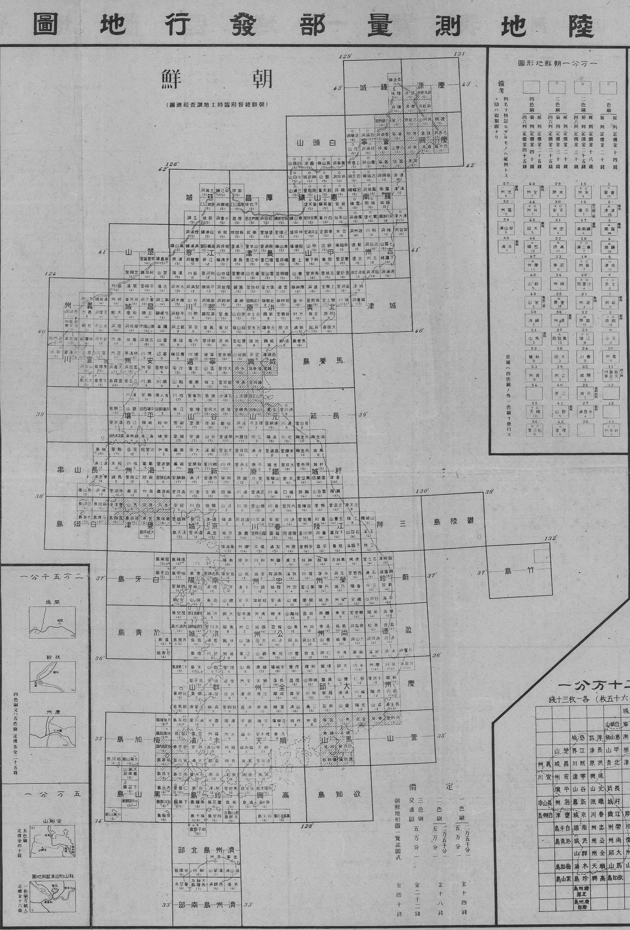
Shin Yong-ha states: "The District Overview Map became an important source in the Allied Forces' recognition that Dokdo is Korean territory when they dismantled the colonies of the Japanese Empire after it collapsed on August 15, 1945." The basis he gives for this in A Historical Explanation of Dokdo (Takeshima) is that "when the Supreme Commander for the Allied Powers promulgated Supreme Command Order 677, in which the Japanese government was directed to cease exercising governmental or administrative authority over areas designated as the Empire of Japan, the grouping of designated areas was almost 100% in line with the District Overview Map." This seems to refer to Supreme Command for Allied Powers Instruction Note (SCAPIN) 677 of January 29, 1946. Article 3 is as follows, with "Liancourt Rocks (Take Island)" referring to Takeshima. "For the purpose of this directive, Japan is defined to include the four main islands of Japan (Hokkaido, Honshu, Kyushu, and Shikoku) and the approximately 1,000 smaller adjacent islands, including the Tsushima Islands and the Ryukyu (Nansei) Islands north of 30° North Latitude (excluding Kuchinoshima Island); and excluding (a) Utsuryo (Ullung) Island, Liancourt Rocks (Take Island) and Quelpart (Saishu or Cheju) Island, (b) the Ryukyu (Nansei) Islands south of 30° North Latitude (including Kuchinoshima Island), the Izu, Nanpo, Bonin (Ogasawara) and Volcano (Kazan or Iwo) Island Groups, and all the other outlying Pacific Islands [including the Daito (Ohigashi or Oagari) Island Group, and Parece Vela (Okino-tori), Marcus (Minami-tori) and Ganges (Nakano-tori) Islands], and (c) the Kurile (Chishima) Islands, the Habomai (Hapomaze) Island Group (including Suisho, Yuri, Akiyuri, Shibotsu and Taraku Islands) and Shikotan Island."
Examining the relationship between the District Overview Map and SCAPIN 677, the first thing to note is the disagreement regarding the Kuril Islands and the Northern Territories; although in the former, the "Chishima Islands [Kuril Islands]" section includes from Urup Island to Shumshu Island, while from Etorofu Island southward is included in the "Hokkaido" section, in the latter the Kuril Islands and the Northern Territories are included in their entirety. There is also a difference regarding the Izu Islands, which are included in their entirety in SCAPIN 677, while in the District Overview Map as far as Torishima Island and Sofugan Island is included in the "Honshu" section. Further discrepancy can be found regarding the Nansei Islands with as far as Amamioshima Island being included in the "Kyushu" section rather than the "Nansei Islands" section, while in SCAPIN 677 Amamioshima Island falls under the description "south of 30° North Latitude" and the area as far as Kuchinoshima Island is in the territory excluded from Japan. Therefore, although Shin Yong-ha says the two agree 100%, the only points of agreement come with Takeshima, the Ogasawara Islands, and Okinawa Prefecture, while there are major discrepancies in the Kuril Islands, the Northern Territories, the Izu Islands, and the Nansei Islands. In short, the statement "The District Overview Map became an important source in the Allied Forces' recognition that Dokdo is Korean territory when they dismantled the colonies of the Japanese Empire after it collapsed on August 15, 1945," can be seen to be entirely groundless. (Continued in Part 2.)
Recommended citation: Funasugi Rikunobu, "Refutation of Korean Media Claims Regarding Japanese Maps of Takeshima," Review of Island Studies, June XX, 2015, http://islandstudies.oprf‐info.org/readings/b000XX/. Translated from "Takeshima no Nihon chizu ni tsuite no Kankokugawa hodo ni taisuru hanron," Tosho Kenkyu Journal, Volume 3 No. 1 (October, 2013), pp. 89-105; published by the OPRF Center for Island Studies.
- Araki Norio, "Ryodo/kokkyo funso ni okeru chizu no kino" (The Function of Maps in Territorial and Border Disputes) in Waseda hogaku Vol. 74, No. 3 (1999) [↩]
- 2012. "Argument That 'Dokdo [Takeshima] Is Korean Territory on Old Maps' Ineffective in International Adjudication: Historical Entitlement May Not Be Considered Important . . . Despite 50 Years Effective Korean Control . . . Japan Has Raised Steady Objections," Hankyoreh, August 17. http://www.hani.co.kr/arti/politics/diplomacy/547540.html (Korean only; accessed on February 27, 2015). [↩]
- Funasugi Rikinobu, "Ezu/chizu kara miru Takeshima: Kankokugawa no shiryo o jirei toshite" (Takeshima as Seen in Old Maps: Taking Korean Materials as Case Studies), in Takeshima mondai ni kansuru chosa kenkyu chukan hokokusho (Interim Report of the Research Study on the Takeshima Issue) (2006); Funasugi Rikinobu, "Ezu/chizu kara miru Takeshima (II)" (Takeshima as Seen in Old Maps [II]) in Takeshima mondai ni kansuru chosa kenkyu saishu hokokusho (Final Report of the Research Study on the Takeshima Issue) (2007); and Funasugi Rikinobu, "Ezu/chizu kara miru Takeshima (III)" (Takeshima as Seen in Old Maps [III]) in Takeshima mondai ni kansuru chosa kenkyu hokokusho: Heisei 19 nendo (Report of the Research Study on the Takeshima Issue: Fiscal 2007) (2008). [↩]
- 2012. "Proof That 'Dokdo is Korean Territory': Restoration of Official Japanese Government Map," Yonhap News, October 24.http://www.yonhapnews.co.kr/bulletin/2012/10/24/0200000000AKR20121024098700004.HTML?1183 (accessed on February 27, 2015). [↩]
- Details on the characters were confirmed on the Gyeongsangbuk-do Office's Division of Dokdo Policy website, http://www.dokdo.go.kr/pages/sub02/page.html?mode=view&mc=0031&type=maps&no=191 (Korean only; accessed on June 16, 2015). [↩]

Born in Hyogo Prefecture in 1970. Graduated from the College of Humanities, First Cluster of Colleges, University of Tsukuba in 1993. Completed the doctoral program without degree in the history and anthropology program at the University of Tsukuba Graduate School of Humanities and Social Sciences in 1999. Became a lecturer in the Faculty of Law and Literature at Shimane University in 1999. Became an associate professor, his current position, in the Faculty of Law and Literature at Shimane University in 2002. Specializes in human geography (historical geography). Was a member of the Shimane Prefecture Takeshima Issue Research Group (first period) from 2005 to 2007. Published essays on the Takeshima issue include “Ezu/chizu kara miru Takeshima: Kankokugawa no shiryo o jirei toshite” (Takeshima as Seen in Old Maps: Taking Korean Materials as Case Studies) in Takeshima mondai ni kansuru chosa kenkyu chukan hokokusho (Interim Report of the Research Study on the Takeshima Issue) (2006), “Ezu/chizu kara miru Takeshima (II)” (Takeshima as Seen in Old Maps [II]) in Takeshima mondai ni kansuru chosa kenkyu saishu hokokusho (Final Report of the Research Study on the Takeshima Issue) (2007), and “Ezu/chizu kara miru Takeshima (III)” (Takeshima as Seen in Old Maps [III]) in Takeshima mondai ni kansuru chosa kenkyu hokokusho: Heisei 19 nendo (Report of the Research Study on the Takeshima Issue: Fiscal 2007) (2008).
Related Research

International Law and Japan's Territorial Disputes
Raul (Pete) Pedrozo (Feb 06, 2018)
The "Critical Date" of the Takeshima Dispute
MIYOSHI Masahiro (Jan 30, 2015)
The Meaning of the Territorial Incorporation of Takeshima (1905)
TSUKAMOTO Takashi (Dec 25, 2014)
The Late-Seventeenth-Century "Takeshima" Dispute, with Reference to the Dajokan Order of 1877
TSUKAMOTO Takashi (Aug 29, 2014)
Related Readings
TAKAHASHI Noritsugu (Sep 15, 2022)
Japan Coast Guard Activities On and Around Takeshima
HIROSE Hajime (Sep 22, 2017)
TSUKAMOTO Takashi (Sep 12, 2016)
International Symposium in Korea on the Takeshima Dispute
SAKAMOTO Shigeki (Jun 10, 2013)