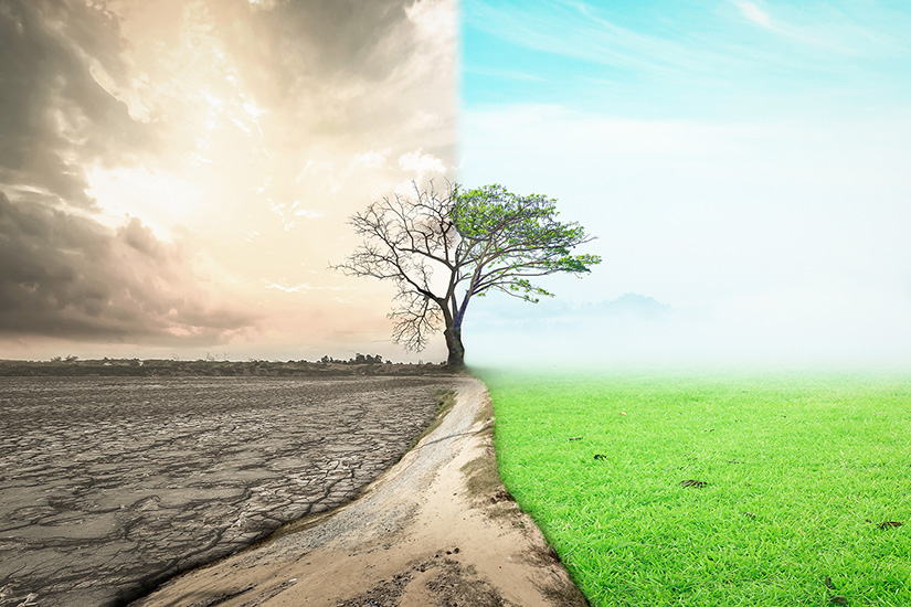
On November 6, 2022, UN Secretary-General António Guterres warned at the start of the COP27 summit in Egypt that "We’re on a highway to hell”. The effects of climate change are manifesting as a security issue, causing conflicts over natural resources and problems resulting from the migration of affected refugees, and they are developing into human security issues in the form of shortages of food, water, and other resources.[1] Moreover, Russia's invasion of Ukraine has further exacerbated this problem. With Africa’s growing population creating concerns about food supply, the destabilization of the supply of Ukrainian wheat and other food resource supply chains threatens to become a global problem. In addition, if oil and gas supplies from Russia are severely constrained, there will be an incentive to return to fossil fuels, which will lead to a downward spiral of further environmental destruction and climate change.
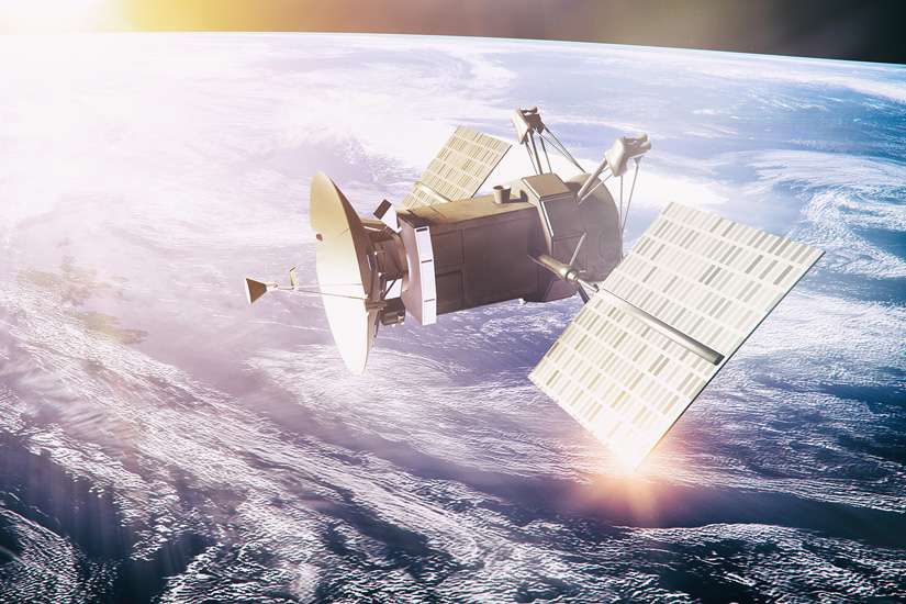
One of the most important aspects of addressing the issue of climate change is to assess the current situation objectively and accurately. In this regard, the development of remote sensing technology[2] in space has made it possible to visualize the current status of events occurring on Earth and changes related to climate change, and to digitize and handle objective data related to these events. There are also high expectations that further technological advances will make it easier to respond to outbreaks of new infectious diseases caused by climate change and to control migrations of climate refugees. The following discusses the current state of development of such technologies and their potential.[3]
Visualizing Earth Space - The Potential of Remote Sensing
In space, many observation satellites equipped with optical and radio sensors are currently orbiting the Earth and collecting information on various aspects of its environment. These include information on sea surface temperatures, atmospheric substances, precipitation conditions, sea surface wind speeds, soil moisture, etc. These data are expected to be utilized in various fields as three-dimensional spatial information, wavelength information such as electromagnetic waves, and information on changes over time. In fact, in 1992, the Global Climate Observing System (GCOS) was put into action with the aim of collecting and providing all users with the observation data and information necessary to solve various climate-related problems. Japan has also been actively involved in GCOS with its comprehensive observation system to detect and monitor the effects of climate change. In particular, the Japan Aerospace Exploration Agency (JAXA), which has developed and operates the observation satellites "SHIKISAI," "SHIZUKU," and "IBUKI," has made a significant contribution to the measurement of the Essential Climate Variable (ECV) of the GCOS by observing global climate change from space using various sensors. Through these efforts, it is possible to clarify phenomena that cannot be confirmed through visual observation or imagery alone by converting land, sea, and air conditions on the Earth into data, and by organically combining various external data and conducting complex analysis.[4] Such advanced technologies and new analytical methods are also expected to make a significant contribution to mitigation and adaptation to the effects of climate change in the future.
In terms of security, there is a growing movement to visualize military events and activities on Earth from space. Information from observation satellites can be used to understand conditions on the ground that cannot be discerned through the visual inspection of maps and layers to determine the specific conditions of human and vehicular activities, and to predict the preliminary stages of crises. There are great expectations for the utilization of such data for strategic information and operational use. In particular, the use of high-resolution three-dimensional information from optical satellites makes it possible to accurately and in detail understand the actual movements and activities of ground troops and equipment, while taking into account changes over time. During the recent invasion of Ukraine, commercial satellite imagery provided by Maxar Technologies and others was an important part of the big data for intelligence. They were comprehensively and centrally processed together with the high-speed, low-latency broadband internet service "Starlink", Radio Frequency (RF) signals and Synthetic Aperture Radar (SAR) information, as well as image data taken by smart phones and other devices in faraway places and near the battlefield. This is because remote sensing satellite information was combined with other non-combat information in a comprehensive manner and played a role in visualizing the entire battlefield through a bird's eye view of the entire battle area.
In Europe, the North Atlantic Treaty Organization (NATO) has taken a proactive stance in addressing the effects of climate change by publishing a report titled "Climate Change and Security Impact Assessment."[5] Within NATO, military satellites and commercial satellites are being combined to track the effects of climate change, such as ocean warming and desertification, with a common space asset, in conjunction with efforts to improve the ability to monitor conditions on the ground and at sea. This NATO initiative will not only monitor the occurrence of large-scale disturbances and disorder in the region, but also predict the migration trends of people displaced by the effects of climate change, paving the way for the use of satellite observation data as dual-use information. The data will be used for both military and civilian purposes.[6] Modeling and forecasting of these data is expected to be conducted by the newly established Canadian Center of Excellence (COE) on Climate Change and Security.[7] The U.S. military is also considering and preparing to actively utilize advanced observation satellite sensors and low-cost weather satellites as part of adapting its forces to the effects of climate change.[8]
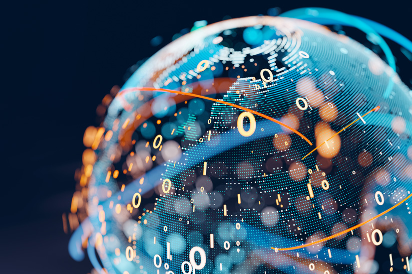
In the future, in addition to these various satellite data, various data collected from land, sea, and air information assets will be integrated and processed through a combination of information and communication technology (ICT), artificial intelligence (AI), quantum computing, and other technologies characterized by high speeds, large capacity, and multiple connections, to generate new real-time information with high added value. This will mean qualitative improvements in intelligence. In addition, if information sharing among satellites becomes smoother through the use of lasers, the convenience of analyzing data on the ground will be greatly enhanced by edge computing,[9] which saves time and effort in processing large-scale space data on the ground.[10]
Potential of Dual-Use Space Systems
As the missions and roles of the military expand with the diversification and globalization of threats, space systems will be used to improve security and military alert monitoring capabilities and to visualize the current and future global issues such as climate change through data analysis.[11] Furthermore, the digitization of such data and the creationof a database for the entire area to be monitored, copying the reality on a virtual space, will realize a digital twinning of the operational domains[12] This means that an environment will be created in which various trials and verifications can be conducted regarding the assessment, mitigation, and adaptation to climate change impacts, in addition to demonstrating the effectiveness of operational planning and the capabilities and suitability of future equipment through the modeling and simulation[13] of critical issues in a digital twinned virtual space. As the military becomes increasingly involved in adapting to and mitigating the effects of climate change, it will be necessary for it to use the data collected and digitized by space assets to efficiently and effectively carry out its dual missions of coping with the effects of climate change and conducting vigilance monitoring from space. The military will move in the direction of efficient and effective dual-use missions of coping with the effects of climate change and vigilance monitoring from space, using data consolidated and digitized by space assets.
Furthermore, if it is possible to continuously detect changes in digital information obtained by observation satellites through AI deep learning and utilize it to predict future trends, it would be a powerful tool to support efforts to accurately predict changes in the global environment due to climate change from the perspective of risk management. It would also enable policymakers to take the initiative in protecting lives and property and preserving biodiversity. In addition, from the perspective of military adaptation to climate change, it would accelerate the use of TTX (Table Top Exercises) and war games (simulation analysis) related to multi-domain operations that organically combine the traditional domains of combat (land, sea, and air) and new domains (space and cyber domains). This would eliminate duplication of valuable space assets and enable the reallocation of national resources to other important domains to effectively maximize the utilization of national space system resources.
Dr. Albert Einstein pointed out the importance of imagination, including flexible and novel ideas: “Imagination is more important than knowledge. For knowledge is limited, whereas imagination embraces the entire world, stimulating progress, giving birth to evolution”. We are called upon to continue to rise to the challenge of global security challenges, such as the effects of climate change and large-scale infectious diseases, without being bound by conventional thinking, in a situation where virtual and real spaces are increasingly merging and operational domains are expanding seamlessly with technological advancement. In this context, outer space, where dependence between the military and civilian sectors is drastically deepening, will undoubtedly play a core role as technology continues its exponential evolution.
(2023/01/16)
Notes
- 1 As of 2018, eight of the ten countries hosting multilateral peace operations personnel are significantly affected by climate change. Florian Krampe, "CLIMATE CHANGE, PEACEBUILDING AND SUSTAINING PEACE," SIPRI Policy Brief, June 2019.
- 2 Refers to a technology for measuring (sensing) the shape and characteristics of an object from a distant place (remote) without touching the object.
- 3 Daniel Araya, "Space: The Final Frontier," Forbes, January 5, 2021.
- 4 JAXA, "Contributions to Climate Change Science," Earth Graphy.
- 5 NATO, "News: NATO releases its Climate Change and Security Impact Assessment," June 28, 2022.
- 6 Jamie Shea, "NATO and Climate Change: Better Late Than Never," The German Marshal Fund, March 11, 2022.
- 7 CDA Institute, "On Canada's NATO Climate Change and Security Center of Excellence (COE)," Jun 30, 2022.
- 8 Sandra Erwin, "DoD focus on climate could shape future investments in weather satellites," SPACENEWS, February 24, 2021.
- 9 Refers to systems that process, analyze, and store data closer to where it is generated, enabling rapid, near real-time analysis and responsiveness. Jon Gold and Keith Shaw, “What is edge computing and why does it matter?” Network World, JUNE 1,2022.
- 10 SPIE, "DARPA and CACI demonstrate optical satellite links," May 19, 2022.
- 11 Morgan R. Edwards et al., "Satellite Data Applications for Sustainable Energy Transitions," Frontier in Sustainability, October 3, 2022.
- 12 Refers to a technology that reproduces various data collected from the real world on a computer as if they were twins.
- 13 Here, refers to a method of better understanding complex systems and deriving valuable solution ideas through modelling, validating and understanding a range of digitized problems.